Esri Arc map 10x
VICTOR OSUNGA
Geospatial Analyst
MOMBASA,14
Satellite imagery analysis
Field data collection
Global positioning systems
GIS software proficiency
GIS analysis
Remote sensing techniques
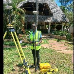
Surveying techniques
Geospatial intelligence
Python programming
Aerial photography interpretation
Geospatial data analysis
Cartography
Data visualization
Map creation
Spatial analysis
Data analysis
Geographic mapping data collection
Remote sensing
Geospatial analysis
GPS navigation
Geospatial data integration
Geospatial professional with experience in spatial data analysis, GIS software, and remote sensing technologies. Known for delivering accurate and actionable insights, ensuring data integrity, and supporting decision-making through advanced geospatial techniques. Strong focus on team collaboration and adaptable to changing project needs. Skilled in spatial data visualization, geospatial data management, and problem-solving. Reliable and results-driven, consistently contributing to project success.
Esri Arc map 10x
Autocad Civil 3D
Global mapper pro
Map source
Google earth pro
Erdas imagine
Envi
Arc GIS Pro